BoatPartsManual.com Logo
BoatPartsManual.comFind exact matching boat parts at once!
FeedbackLoginSign UpProfileWishlistChatAdd ProductLog Out

Menu

FeedbackLoginSign Up

© 2025 BoatPartsManual.com. All Rights Reserved.

Select your boat's brand and model to find compatible parts.

Product Categories

All Categories
Anchoring & Docking
Boats, Tenders & Watersports
Cabin, Galley & Comfort
Clothing & Apparel
Deck & Sailing Hardware
Electrical & Power
Electronics & Navigation
Engine, Propulsion & Trailering
Fishing
Maintenance & Care
Navigation, Charts & Books
Plumbing & Sanitation
Safety
  1. Home
  2. Categories
  3. Electronics & Navigation
  4. Navigation Displays & Systems
  5. Fishfinders & Depth Sounders
  6. (25)
Sort by:
Back to Navigation Displays & Systems
Sort by:

Fishfinders & Depth Sounders

(25)

Filters

Eagle 4X with Bullet Transducer
100%

Eagle 4X with Bullet Transducer

LOWRANCE
Autotuning Sonar Use sonar auto-tuning to get the best sonar image every time and save time that you would otherwise have to spend on manual adjustment. Designed for Fishing The new IPS screen has improved resolution for clarity and visibility even in direct sunlight and polarised sunglasses. Thanks to the wide-angle sonar, the Bullet transducer offers greater coverage with a continuous scroll from right to left across the screen, making it easier to interpret and locate fish. New Connection System Eagle's improved twist-lock connection system allows for easy installation and removal, making Eagle a great portable solution for any type of fishing. Technical data: Display: 4" (102 mm) Resolution: 272 x 480 px Frequency: 200 kHz Max. Power consumption: 6.1 W Waterproof: Yes Features Discover the features that make this product stand out. From technical details to special functions – we’ve summarized all the key information for you. Display size 4 Inch Operating mode Keys With transducer NMEA0183 No Radar capable No Sonar module Yes
Eagle 5 with SplitShot™ HD Transducer
100%

Eagle 5 with SplitShot™ HD Transducer

LOWRANCE
Autotuning Sonar Use sonar auto-tuning to get the best sonar image every time and save time that you would otherwise have to spend on manual adjustment. SplitShot™ HD The SplitShot™ HD transducer delivers high-resolution underwater views below the boat. It combines the ability to find fish using wide-angle, high-resolution CHIRP sonar with the high-resolution images of fish-bearing structures from DownScan Imaging™. FishReveal™ Fish identification just got easier - the FishReveal™ combines DownScan with CHIRP to provide unrivalled target discrimination and identification. Designed for Fishing The new IPS screen has improved resolution for clarity and visibility even in direct sunlight and polarised sunglasses. Detailed mapping WORLDWIDE BASEMAP: Pre-installed with worldwide base map content, the fishfinder offers the option of upgrading to CMAP® DISCOVER™ or other chart services. The Lowrance Eagle makes it easy to navigate and discover fishing spots. GENESIS LIVE: Local lakes or unexplored waters can be customised on a ½-foot contour map in real time thanks to GENESIS LIVE. New Connection System Eagle's improved twist-lock connection system allows for easy installation and removal, making Eagle a great portable solution for any type of fishing. Technical specifications Display: 4" (102 mm) Resolution: 272 x 480 px Frequency: 200 kHz Max. Power consumption: 12.2 W Waterproof: Yes Features Discover the features that make this product stand out. From technical details to special functions – we’ve summarized all the key information for you. Display size 5 Inch Operating mode Keys With transducer NMEA0183 No Radar capable No Sonar module Yes Viewing angle Downwards
Eagle 7 with SplitShot™ HD Transducer
100%

Eagle 7 with SplitShot™ HD Transducer

LOWRANCE
Autotuning Sonar Use sonar auto-tuning to get the best sonar image every time and save time that you would otherwise have to spend on manual adjustment. SplitShot™ HD The SplitShot™ HD transducer delivers high-resolution underwater views below the boat. It combines the ability to find fish using wide-angle, high-resolution CHIRP sonar with the high-resolution images of fish-bearing structures from DownScan Imaging™. FishReveal™ Fish identification just got easier - the FishReveal™ combines DownScan with CHIRP to provide unrivalled target discrimination and identification. Designed for Fishing The new IPS screen has improved resolution for clarity and visibility even in direct sunlight and polarised sunglasses. Detailed mapping WORLDWIDE BASEMAP: Pre-installed with worldwide base map content, the fishfinder offers the option of upgrading to CMAP® DISCOVER™ or other chart services. The Lowrance Eagle makes it easy to navigate and discover fishing spots. GENESIS LIVE: Local lakes or unexplored waters can be customised on a ½-foot contour map in real time thanks to GENESIS LIVE. New Connection System Eagle's improved twist-lock connection system allows for easy installation and removal, making Eagle a great portable solution for any type of fishing. Technical specifications Display: 7" (177.8 mm) Resolution: 800 x 480 px Frequency: 200 kHz Max. Power consumption: 16.3 W Waterproof: Yes Features Discover the features that make this product stand out. From technical details to special functions – we’ve summarized all the key information for you. Display size 7 Inch Operating mode Keys With transducer NMEA0183 No Radar capable No Sonar module Yes Viewing angle Downwards
Eagle 7 with TripleShot™ HD Transducer
100%

Eagle 7 with TripleShot™ HD Transducer

LOWRANCE
Autotuning Sonar Use sonar auto-tuning to get the best sonar image every time and save time that you would otherwise have to spend on manual adjustment. TripleShot™ HD The easiest way to find fish - the TripleShot™ HD offers an underwater view downwards and to the side, combined in one transducer. Side- and DownScan provide razor-sharp images of structures containing fish. FishReveal™ Fish identification just got easier - the FishReveal™ combines DownScan with CHIRP to provide unrivalled target discrimination and identification. Designed for Fishing The new IPS screen has improved resolution for clarity and visibility even in direct sunlight and polarised sunglasses. Detailed mapping WORLDWIDE BASEMAP: Pre-installed with worldwide base map content, the fishfinder offers the option of upgrading to CMAP® DISCOVER™ or other chart services. The Lowrance Eagle makes it easy to navigate and discover fishing spots. GENESIS LIVE: Local lakes or unexplored waters can be customised on a ½-foot contour map in real time thanks to GENESIS LIVE. New Connection System Eagle's improved twist-lock connection system allows for easy installation and removal, making Eagle a great portable solution for any type of fishing. Technical specifications Display: 7" (177.8 mm) Resolution: 800 x 480 px Frequency: 200 kHz Max. Power consumption: 16.3 W Waterproof: Yes Features Discover the features that make this product stand out. From technical details to special functions – we’ve summarized all the key information for you. Display size 7 Inch Operating mode Keys With transducer NMEA0183 No Radar capable No Sonar module Yes Viewing angle Downwards Sidewards
Eagle 9 with TripleShot™ HD Transducer
100%

Eagle 9 with TripleShot™ HD Transducer

LOWRANCE
Autotuning Sonar Use sonar auto-tuning to get the best sonar image every time and save time that you would otherwise have to spend on manual adjustment. TripleShot™ HD The easiest way to find fish - the TripleShot™ HD offers an underwater view downwards and to the side, combined in one transducer. Side- and DownScan provide razor-sharp images of structures containing fish. FishReveal™ Fish identification just got easier - the FishReveal™ combines DownScan with CHIRP to provide unrivalled target discrimination and identification. Designed for Fishing The new IPS screen has improved resolution for clarity and visibility even in direct sunlight and polarised sunglasses. Detailed mapping WORLDWIDE BASEMAP: Pre-installed with worldwide base map content, the fishfinder offers the option of upgrading to CMAP® DISCOVER™ or other chart services. The Lowrance Eagle makes it easy to navigate and discover fishing spots. GENESIS LIVE: Local lakes or unexplored waters can be customised on a ½-foot contour map in real time thanks to GENESIS LIVE. New Connection System Eagle's improved twist-lock connection system allows for easy installation and removal, making Eagle a great portable solution for any type of fishing. Technical specifications Display: 9" (228.6 mm) Resolution: 1024 x 600 px Frequency: 200 kHz Max. Power consumption: 19.4 W Waterproof: Yes Features Discover the features that make this product stand out. From technical details to special functions – we’ve summarized all the key information for you. Display size 9 Inch Operating mode Keys With transducer NMEA0183 No Radar capable No Sonar module Yes Viewing angle Downwards Sidewards
Element 12 HV / buttons / with Hypervision Chirp Sonar and HV-100 transducer
100%

Element 12 HV/ buttons/ with Hypervision Chirp Sonar and HV-100 transducer

RAYMARINE
Smart 12" multifunction display with user-friendly interface and integrated GPS antenna. A classic keypad and the Raymarine LightHouse Sport interface make for intuitive operation. With built-in HyperVision sonar technology for outstanding image quality of the underwater world. The fast QuadCore processor is more than adequate for mapping and continuous 3D rendering. HV-100 transducer included. Raymarine Quantum Radar The Raymarine Quantum radar antenna can be connected to the ELEMENT-S via the integrated WiFi interface. Raymarine QUANTUM is the next generation of marine radar antennas with CHIRP technology. The QUANTUM provides razor-sharp images over both short and long distances. NMEA2000 Support With the NMEA2000 (Micro-C) interface you can clearly display AIS, tank, engine, compass and wind data. This allows you to view incoming AIS targets directly on nautical charts and keep an eye on the surrounding shipping traffic. With the help of the data bar you can monitor your current tank levels for instance. HyperVision 1.2 MHz Sonar Technology HyperVision sonar technology uses top frequencies of up to 1.2 megahertz and CHIRP technology. This allows for a much higher image resolution compared to other systems. The top frequency of 1.2 MHz can reach a range of up to 30 meters at a beam angle of 180°. Use it to bring DownVision, SideVision and RealVision 3D imaging to a new level and to see structures, underwater vegetation and fish in photo-like clarity. With the standard 350 kHz CHIRP sonar, you can receive high-resolution images at a range of up to 183 meters (DownVision) and 91 meters (SideVision / RealVision 3D). In addition, the classic CHIRP sonar operates at 200 kHz down to a depth of 274 metres. Raymarine LightHouse Sport Intuitive and visually striking user interface. Thanks to pre-configured home screens, every user has the start screen needed for his or her needs immediately at hand. Thanks to the ergonomically positioned buttons, navigation through the menus and placing waypoints and routes is quick and easy even without a touchscreen. Through an NMEA2000 interface, the Element-S can display a wide range of data from external devices such as AIS receivers or tank sensors. Your own nautical charts with RealBathy With the new RealBathy function you can create your own nautical charts. Simply activate the function and your Element multifunction display with sonar function will create the nautical chart of your area. You can determine the overlay and display safety depths. Insert a large enough memory card into your device to do so. Technical Specifications Screen size 12" Touchscreen Non-Touch Screen resolution 1280x800 Brightness 1500 Nits Network and compatibility GPS Integrated GPS / GNSS receiver: GPS / GLONASS Sonar CHIRP Sonar, DownVision (Standard and Hyper), SideVision (Standard and Hyper), Realvision 3D (Standard and Hyper) Sonar connection 15-pin HyperVision ™ connector Sonar depth CHIRP sonar = 274 m (900 feet) DownVision ™ Standard = 183m (600ft) | DownVision ™ Hyper = 30m (100ft) SideVision ™ Standard = 91 m (300 feet) | SideVision ™ Hyper = 30m (100ft) RealVision ™ 3D Standard = 91 m (300 feet) | RealVision ™ 3D Hyper = 30m (100ft) Nautical charts specification Supported nautical charts Raymarine LightHouse NC2, Navionics, C-MAP Essentials, C-MAP 4D MAX + and all charts listed on the Raymarine Chart Store. Waypoints routes 10,000 waypoints / 200 waypoints groups / 150 routes with max 250 waypoints / 16 tracks - 10,000 track points per track Other specifications Interfaces NMEA2000-Limited (engine, tank sensor & compass data input, data output: GPS for radio), Wi-Fi, Bluetooth For NMEA2000 GPS and AIS data update free of charge to the current Element Lighthouse Version 3.9. More information can be found on the Raymarine support page. Dimensions 357 x 215 x 62 mm Nominal voltage 12V DC (8V - 16V DC) Current consumption 25 W Water resistance IPX6 and IPX7 Operating temperature -25 ° C to + 55 ° C Includes Mounting bracket with fixings, surface mounting kit with fixings, sun shade, 1.5 m power / NMEA2000 cable, documentation, HV-100 transducer with 6 m cable transom mount with mounting parts, P-clips with mounting screws, cover plate with mounting parts Depth / fishfinder views Depending on the optionally connected transducers, the chartplotter can display the following depth views. The pure depth display refers to transducer data received via an NMEA0183 or NMEA2000 interface. Some functions can be retrofitted via external modules. Pure depth representation Fishfinder / CHIRP Down vision RealVision 3D Compatible with: Find your suitable nautical chart with the nautical chart finder now » Charts module: SD / Micro SD CompactFlash C-Card MAX orange C-Card NT + black Compatible with the following nautical charts: C-MAP 4D C-MAP 4D Full C-MAP 4D Continental Navionics + Navionics Platinum + Nautical charts features: Chart system Vector maps Raster / paper charts Easy- / AutoRouting Tide display Satellite images High-resolution depth lines C-MAP 4D C-MAP 4D Full C-MAP 4D Continental Navionics + Navionics Platinum + Features Discover the features that make this product stand out. From technical details to special functions – we’ve summarized all the key information for you. Display size 12 Inch Operating mode Keys With transducer NMEA0183 No NMEA2000 WiFi Bluetooth Radar capable Yes (only via WiFi) Sonar module Yes Viewing angle Downwards Sidewards Sonar view Fish Bottom structure 3D bottom structure
Element 12 HV / buttons / with Hypervision Chirp Sonar without transducer
100%

Element 12 HV/ buttons/ with Hypervision Chirp Sonar without transducer

RAYMARINE
Smart 12" multifunction display with user-friendly interface and integrated GPS antenna. A classic keypad and the Raymarine LightHouse Sport interface make for intuitive operation. With built-in HyperVision sonar technology for outstanding image quality of the underwater world. The fast QuadCore processor is more than adequate for mapping and continuous 3D rendering. Supplied without transducer. Raymarine Quantum Radar The Raymarine Quantum radar antenna can be connected to the ELEMENT-HV via the integrated WiFi interface. Raymarine QUANTUM is the next generation of marine radar antennas with CHIRP technology. The QUANTUM provides razor-sharp images over both short and long distances. NMEA2000 Support With the NMEA2000 (Micro-C) interface you can clearly display AIS, tank, engine, compass and wind data. This allows you to view incoming AIS targets directly on nautical charts and keep an eye on the surrounding shipping traffic. With the help of the data bar you can monitor your current tank levels for instance. HyperVision 1.2 MHz Sonar Technology HyperVision sonar technology uses top frequencies of up to 1.2 megahertz and CHIRP technology. This allows for a much higher image resolution compared to other systems. The top frequency of 1.2 MHz can reach a range of up to 30 meters at a beam angle of 180°. Use it to bring DownVision, SideVision and RealVision 3D imaging to a new level and to see structures, underwater vegetation and fish in photo-like clarity. With the standard 350 kHz CHIRP sonar, you can receive high-resolution images at a range of up to 183 meters (DownVision) and 91 meters (SideVision / RealVision 3D). In addition, the classic CHIRP sonar operates at 200 kHz down to a depth of 274 metres. Raymarine LightHouse Sport Intuitive and visually striking user interface. Thanks to pre-configured home screens, every user has the start screen needed for his or her needs immediately at hand. Thanks to the ergonomically positioned buttons, navigation through the menus and placing waypoints and routes is quick and easy even without a touchscreen. Through an NMEA2000 interface, the Element-HV can display a wide range of data from external devices such as AIS receivers or tank sensors. Your own nautical charts with RealBathy With the new RealBathy function you can create your own nautical charts. Simply activate the function and your Element multifunction display with sonar function will create the nautical chart of your area. You can determine the overlay and display safety depths. Insert a large enough memory card into your device to do so. Technical specifications Screen size 12" Touchscreen Non-Touch Screen resolution 1280x800 Brightness 1500 Nits Network and compatibility GPS Integrated GPS / GNSS receiver: GPS / GLONASS sonar CHIRP Sonar, DownVision (Standard and Hyper), SideVision (Standard and Hyper), Realvision 3D (Standard and Hyper) Sonar connection 15-pin HyperVision ™ connector Sonar depth CHIRP sonar = 274 m (900 feet) DownVision ™ Standard = 183m (600ft) | DownVision ™ Hyper = 30m (100ft) SideVision ™ Standard = 91 m (300 feet) | SideVision ™ Hyper = 30m (100ft) RealVision ™ 3D Standard = 91 m (300 feet) | RealVision ™ 3D Hyper = 30m (100ft) Nautical charts specification Supported nautical charts Raymarine LightHouse NC2, Navionics, C-MAP Essentials, C-MAP 4D MAX + and all charts listed on the Raymarine Chart Store. Waypoints routes 10,000 waypoints / 200 waypoints groups / 150 routes with max 250 waypoints / 16 tracks - 10,000 track points per track Other specifications Interfaces NMEA2000-Limited (engine, tank sensor & compass data input, data output: GPS for radio), Wi-Fi, Bluetooth For NMEA2000 GPS and AIS data update free of charge to the current Element Lighthouse Version 3.9. More information can be found on the Raymarine support page. Dimensions 357 x 215 x 62 mm Nominal voltage 12V DC (8V - 16V DC) Current consumption 25 W Water resistance IPX6 and IPX7 Operating temperature -25 ° C to + 55 ° C Includes Mounting bracket with fixings, surface mounting kit with fixings, sun shade, 1.5 m power / NMEA2000 cable, documentation Depth / fishfinder views Depending on the optionally connected transducers, the chartplotter can display the following depth views. The pure depth display refers to transducer data received via an NMEA0183 or NMEA2000 interface. Some functions can be retrofitted via external modules. Pure depth representation Fishfinder / CHIRP Down vision RealVision 3D Compatible with: Find your suitable nautical chart with the nautical chart finder now » Charts module: SD / Micro SD CompactFlash C-Card MAX orange C-Card NT + black Compatible with the following nautical charts: C-MAP 4D C-MAP 4D Full C-MAP 4D Continental Navionics + Navionics Platinum + Nautical charts features: Chart system Vector maps Raster / paper charts Easy- / AutoRouting Tide display Satellite images High-resolution depth lines C-MAP 4D C-MAP 4D Full C-MAP 4D Continental Navionics + Navionics Platinum + Features Discover the features that make this product stand out. From technical details to special functions – we’ve summarized all the key information for you. Display size 12 Inch Operating mode Keys NMEA0183 No NMEA2000 WiFi Bluetooth Radar capable Yes (only via WiFi) Sonar module Yes Viewing angle Downwards Sidewards Sonar view Fish Bottom structure 3D bottom structure
Element 12S / buttons / CHIRP Sonar Module
100%

Element 12S/ buttons/ CHIRP Sonar Module

RAYMARINE
Smart 12" multifunction display with user-friendly interface, integrated GPS antenna and built-in CHIRP sonar module. A classic keypad and the Raymarine LightHouse Sport interface make for intuitive operation, further enhanced by custom programmable function keys. A built-in QuadCore processor provides plenty of computing power. Easy networking thanks to NMEA2000 connection. Raymarine LightHouse Sport Intuitive and visually striking user interface. Thanks to pre-configured home screens, every user has the start screen needed for his or her needs immediately at hand. With the ergonomically positioned buttons, navigation through the menus and placing waypoints and routes is quick and easy even without a touchscreen. Through an NMEA2000 interface, the Element-S can display a wide range of data from external devices such as AIS receivers or tank sensors. Choose from a wide range of sailing areas with support for Navionics and C-MAP 4D charts. Raymarine Quantum Radar The Raymarine Quantum radar antenna can be connected to the ELEMENT-S via the integrated WiFi interface. Raymarine QUANTUM is the next generation of marine radar antennas with CHIRP technology. The QUANTUM provides razor-sharp images over both short and long distances. NMEA2000 support With the NMEA2000 (Micro-C) interface you can clearly display AIS, tank, engine, compass and wind data. This allows you to view incoming AIS targets directly on nautical charts and keep an eye on the surrounding shipping traffic. With the help of the data bar you can monitor your current tank levels for instance. Fishfinder - CHIRP Go underwater hunting with the Element S series. Spend more time catching fish and less time searching! The CHIRP Fishfinder module (transmitter/transducer optional) provides high-resolution underwater images. Recommended transducers CPT-S Transom Transducer CPT-S Thru-Hull Transducer Both transducers can be used for fishfinder CHIRP display: Fishfinder chirp Depth / fishfinder views Depending on which the transducer is connected, the chartplotter can display the following depth views. The pure depth display refers to transducer data received via NMEA0183 or NMEA2000 interface. Some functions can be retrofitted via external modules. Pure depth representation Fish finder / CHIRP Down vision RealVision 3D Technical specifications Screen size 12" Touchscreen Non-Touch Screen resolution 1280 x 800 Brightness 1500 nits Network and compatibility GPS Integrated GPS / GNSS receiver: GPS / GLONASS Nautical charts specification Supported nautical charts Raymarine LightHouse NC2, Navionics, C-MAP Essentials, C-MAP 4D MAX+ and all charts listed on the Raymarine Chart Store. Waypoints routes 10,000 waypoints / 200 waypoints groups / 250 routes with max. 500 waypoints / 15 tracks - 10,000 track points per track Other specifications NMEA2000 Data input: engine, tank sensor, compass, AIS, depth, wind and speed data Data output: GPS data for radios, waypoints and routes for autopilots Other interfaces Wi-Fi Dimensions 357 x 215 x 62 mm Nominal voltage 12 V DC (8 V - 16 V DC) Power consumption (amps) 25 W Water rating IPX6 and IPX7 Operating temperature -25 °C to + 55 °C Chart module: SD/Micro-SD Compactflash C-Card MAX orange C-Card NT+ black Compatible with the following charts: C-MAP 4D C-MAP 4D Full C-MAP 4D Continental Navionics+ Navionics Platinum+ Chart features: Chart system Vector maps Grid/paper charts Easy/Autorouting Tides Satellite images High-resolution depth lines C-MAP 4D C-MAP 4D Full C-MAP 4D Continental Navionics+ Navionics Platinum+ Included in delivery Element display Surface mount gasket Suncover Trunnion knobs Mounting bracket Fastening material Power and data cable Features Discover the features that make this product stand out. From technical details to special functions – we’ve summarized all the key information for you. Display size 12 Inch Operating mode Keys NMEA0183 No NMEA2000 WiFi Bluetooth Radar capable Yes (only via WiFi) Sonar module Yes Viewing angle Downwards Sonar view Fish
ELEMENT 7 HV / buttons / with CPT-100 Transom Transducer
100%

ELEMENT 7 HV/ buttons/ with CPT-100 Transom Transducer

RAYMARINE
Smart 7" multifunction display with integrated GPS antenna and built in sonar module. A touchscreen was deliberately omitted in the design of this Raymarine plotter, as the classic keypad and the Raymarine LightHouse Sport interface make for intuitive operation, also at high speeds and rough seas. Thanks to the CPT-100 DVS transducer, you can find your way around in no time at all using the DownVision and CHIRP view. An integrated QuadCore processor provides the necessary computing power. Easy networking thanks to NMEA2000 connection. Raymarine LightHouse Sport Intuitive and visually striking user interface. Thanks to pre-configured home screens, every user has the start screen needed for his or her needs immediately at hand. Thanks to the ergonomically positioned buttons, navigation through the menus and placing waypoints and routes is quick and easy even without a touchscreen. Through an NMEA2000 interface, the Element can display a wide range of data from external devices such as AIS receivers or tank sensors. Take advantage and choose from a variety of shipping areas. Support for Navionics and C-MAP 4D nautical charts makes it possible. Raymarine Quantum Radar The Raymarine Quantum radar antenna can be connected to the ELEMENT-HV via the integrated WiFi interface. The Raymarine QUANTUM is the next generation of marine radar antennas with CHIRP technology. The QUANTUM impresses with pin-sharp images on both short and long distances. NMEA2000 support With the NMEA2000 (Micro-C) interface you can clearly display AIS, tank, engine, compass and wind data. This allows you to view incoming AIS targets directly on nautical charts and keep an eye on the surrounding shipping traffic. With the help of the data bar you can monitor your current tank levels for instance. Fish Finder - CHIRP Go underwater hunting with the Element series. Spend more time catching fish and less time searching! This is made possible by the integrated FishFinder module and CPT-100 DVS transom transducer, which is included in the delivery, providing high-resolution underwater pictures. Take advantage and find fish quickly and reliably with the help of the DownVision and CHIRP view. Depth / fishfinder views Depending on which transducer is connected, the chartplotter can display the following depth views. The pure depth display refers to transducer data received via an NMEA0183 or NMEA2000 interface. Some functions can be retrofitted via external modules. Pure depth display Fishfinder / CHIRP Down vision RealVision 3D Technical specifications Screen size 7" Touchscreen Non-touch / no touch Screen resolution 800 x 480 Brightness 1500 nits Network and compatibility GPS Integrated GPS / GNSS receiver: GPS / GLONASS Nautical charts specification Supported nautical charts Raymarine LightHouse NC2, Navionics, C-MAP Essentials, C-MAP 4D MAX + and all maps listed in the Raymarine Chart Store. Waypoints routes 10,000 waypoints / 200 waypoints groups / 250 routes with max. 500 waypoints / 15 tracks - 10,000 track points per track More specifications NMEA2000 Data input: engine, tank sensor, compass, AIS, depth, wind and speed data Data output: GPS data for radios, waypoints and routes for autopilots Other interfaces Wi-Fi Dimensions 240 x 135 x 62 mm Nominal voltage 12 V DC (8 V - 16 V DC) Current consumption 15 W. Water resistance IPX6 and IPX7 Operating temperature -25 ° C to + 55 ° C Nautical charts module: SD / Micro SD CompactFlash C-Card MAX orange C-Card NT + black Compatible with the following charts: C-MAP 4D C-MAP 4D Full C-MAP 4D Continental Navionics + Navionics Platinum + Nautical Chart Features: Chart system Vector maps Raster / paper charts Easy- / AutoRouting Tide display Satellite images High-resolution depth lines C-MAP 4D C-MAP 4D Full C-MAP 4D Continental Navionics + Navionics Platinum + Included Element display Seals for surface mounting Suncover Screws Mounting bracket Mounting material Power and data cables Features Discover the features that make this product stand out. From technical details to special functions – we’ve summarized all the key information for you. Display size 7 Inch Operating mode Keys With transducer NMEA0183 No NMEA2000 WiFi Bluetooth Radar capable Yes (only via WiFi) Sonar module Yes Viewing angle Downwards Sonar view Fish Bottom structure
Element 7 HV / buttons / with Hypervision Sonar and HV-100 Transducer
100%

Element 7 HV/ buttons/ with Hypervision Sonar and HV-100 Transducer

RAYMARINE
Smart 7" multifunction display with user-friendly interface and integrated GPS antenna. A classic keypad and the Raymarine LightHouse Sport interface make for intuitive operation. With built-in HyperVision sonar technology for outstanding image quality of the underwater world. The fast QuadCore processor is more than adequate for mapping and continuous 3D rendering. HV-100 transducer included. Raymarine Quantum Radar The Raymarine Quantum radar antenna can be connected to the ELEMENT-HV via the integrated WiFi interface. Raymarine QUANTUM is the next generation of marine radar antennas with CHIRP technology. The QUANTUM provides razor-sharp images over both short and long distances. NMEA2000 Support With the NMEA2000 (Micro-C) interface you can clearly display AIS, tank, engine, compass and wind data. This allows you to view incoming AIS targets directly on nautical charts and keep an eye on the surrounding shipping traffic. With the help of the data bar you can monitor your current tank levels for instance. HyperVision 1.2 MHz Sonar Technology HyperVision sonar technology uses top frequencies of up to 1.2 megahertz and CHIRP technology. This allows for a much higher image resolution compared to other systems. The top frequency of 1.2 MHz can reach a range of up to 30 meters at a beam angle of 180°. Use it to bring DownVision, SideVision and RealVision 3D imaging to a new level and to see structures, underwater vegetation and fish in photo-like clarity. With the standard 350 kHz CHIRP sonar, you can receive high-resolution images at a range of up to 183 meters (DownVision) and 91 meters (SideVision / RealVision 3D). In addition, the classic CHIRP sonar operates at 200 kHz down to a depth of 274 metres. Raymarine LightHouse Sport Intuitive and visually striking user interface. Thanks to pre-configured home screens, every user has the start screen needed for his or her needs immediately at hand. Thanks to the ergonomically positioned buttons, navigation through the menus and placing waypoints and routes is quick and easy even without a touchscreen. Through an NMEA2000 interface, the Element-HV can display a wide range of data from external devices such as AIS receivers or tank sensors. Your own nautical charts with RealBathy With the new RealBathy function you can create your own nautical charts. Simply activate the function and your Element multifunction display with sonar function will create the nautical chart of your area. You can determine the overlay and display safety depths. Insert a large enough memory card into your device to do so. Technical Specifications Screen size 7" Touchscreen Non-Touch Screen resolution 800x480 Brightness 1500 Nits Network and compatibility GPS Integrated GPS / GNSS receiver: GPS / GLONASS sonar CHIRP Sonar, DownVision (Standard and Hyper), SideVision (Standard and Hyper), Realvision 3D (Standard and Hyper) Sonar in the network Yes Nautical charts specification Supported nautical charts Raymarine LightHouse NC2, Navionics, C-MAP Essentials, C-MAP 4D MAX + and all charts listed on the Raymarine Chart Store. Waypoints routes 10,000 waypoints / 200 waypoints groups / 150 routes with max 250 waypoints / 16 tracks - 10,000 track points per track Other specifications Interfaces NMEA2000-Limited (engine, tank sensor & compass data input, data output: GPS for radio), Wi-Fi, Bluetooth For NMEA2000 GPS and AIS data update free of charge to the current Element Lighthouse Version 3.9. More information can be found on the Raymarine support page. Dimensions 240 x 135 x 62 mm Nominal voltage 12V DC (8V - 16V DC) Current consumption 15W Water resistance IPX6 and IPX7 Operating temperature -25 ° C to + 55 ° C Depth / fishfinder views Depending on the optionally connected transducers, the chartplotter can display the following depth views. The pure depth display refers to transducer data received via an NMEA0183 or NMEA2000 interface. Some functions can be retrofitted via external modules. Pure depth Display Fishfinder / CHIRP Down vision RealVision 3D Compatible with: Find your suitable nautical chart with the nautical chart finder now » Charts module: SD / Micro SD CompactFlash C-Card MAX orange C-Card NT + black Compatible with the following nautical charts: C-MAP 4D C-MAP 4D Full C-MAP 4D Continental Navionics + Navionics Platinum + Nautical charts features: Chart system Vector maps Raster / paper charts Easy- / AutoRouting Tide display Satellite images High-resolution depth lines C-MAP 4D C-MAP 4D Full C-MAP 4D Continental Navionics + Navionics Platinum + Features Discover the features that make this product stand out. From technical details to special functions – we’ve summarized all the key information for you. Display size 7 Inch Operating mode Keys With transducer NMEA0183 No NMEA2000 WiFi Bluetooth Radar capable Yes (only via WiFi) Sonar module Yes Viewing angle Downwards Sidewards Sonar view Fish Bottom structure 3D bottom structure
Element 7 HV / buttons / with HyperVision Sonar without transducer
100%

Element 7 HV/ buttons/ with HyperVision Sonar without transducer

RAYMARINE
Smart 7" multifunction display with user-friendly interface and integrated GPS antenna. A classic keypad and the Raymarine LightHouse Sport interface make for intuitive operation. With built-in HyperVision sonar technology for outstanding image quality of the underwater world. The fast QuadCore processor is more than adequate for mapping and continuous 3D rendering. Supplied without transducer. Raymarine Quantum Radar The Raymarine Quantum radar antenna can be connected to the ELEMENT-HV via the integrated WiFi interface. The Raymarine QUANTUM is the next generation of marine radar antennas with CHIRP technology. The QUANTUM impresses with pin-sharp images on both short and long distances. NMEA2000 support With the NMEA2000 (Micro-C) interface you can clearly display AIS, tank, engine, compass and wind data. This allows you to view incoming AIS targets directly on nautical charts and keep an eye on the surrounding shipping traffic. With the help of the data bar you can monitor your current tank levels for instance. HyperVision 1.2 MHz Sonar Technology HyperVision sonar technology uses top frequencies of up to 1.2 megahertz and CHIRP technology. This allows for a much higher image resolution compared to other systems. The top frequency of 1.2 MHz can reach a range of up to 30 meters at a beam angle of 180°. Use it to bring DownVision, SideVision and RealVision 3D imaging to a new level and to see structures, underwater vegetation and fish in photo-like clarity. With the standard 350 kHz CHIRP sonar, you can receive high-resolution images at a range of up to 183 meters (DownVision) and 91 meters (SideVision / RealVision 3D). In addition, the classic CHIRP sonar operates at 200 kHz down to a depth of 274 metres. Raymarine LightHouse Sport Intuitive and visually striking user interface. Thanks to pre-configured home screens, every user has the start screen needed for his or her needs immediately at hand. Thanks to the ergonomically positioned buttons, navigation through the menus and placing waypoints and routes is quick and easy even without a touchscreen. Through an NMEA2000 interface, the Element-S can display a wide range of data from external devices such as AIS receivers or tank sensors. Your own nautical charts with RealBathy With the new RealBathy function you can create your own nautical charts. Simply activate the function and your Element multifunction display with sonar function will create the nautical chart of your area. You can determine the overlay and display safety depths. Insert a large enough memory card into your device to do so. Technical specifications Screen size 7" Touchscreen Non-touch Screen resolution 800x480 Brightness 1500 Nits Network and compatibility GPS Integrated GPS / GNSS receiver: GPS / GLONASS Sonar CHIRP Sonar, DownVision (Standard and Hyper), SideVision (Standard and Hyper), Realvision 3D (Standard and Hyper) Sonar in the network Yes Nautical charts specification Supported nautical charts Raymarine LightHouse NC2, Navionics, C-MAP Essentials, C-MAP 4D MAX + and all charts listed on the Raymarine Chart Store. Waypoints routes 10,000 waypoints / 200 waypoints groups / 150 rods with max 250 waypoints / 16 tracks - 10,000 track points per track Other specifications Interfaces NMEA2000-Limited (data input engine, tank sensor, compass, GPS and AIS data data output: GPS for radio), Wi-Fi, Bluetooth. For NMEA2000 GPS and AIS data update to the current Element Lighthouse version 3.9 free of charge. For more information, visit the Raymarine Support page. Dimensions 240 x 135 x 62 mm Nominal voltage 12V DC (8V - 16V DC) Current consumption 15W Water resistance IPX6 and IPX7 Operating temperature -25 ° C to + 55 ° C Depth / fishfinder views Depending on the optionally connected transducers, the chartplotter can display the following depth views. The pure depth display refers to transducer data received via a NMEA0183 or NMEA2000 interface. Some functions can be retrofitted via external modules. Pure depth representation Fishfinder / CHIRP Down vision RealVision 3D Compatible with: Find your suitable nautical chart with the nautical chart finder now » Chart module: SD / Micro SD CompactFlash C-Card MAX orange C-Card NT + black Compatible with the following nautical charts: C-MAP 4D C-MAP 4D Full C-MAP 4D Continental Navionics + Navionics Platinum + Nautical chart features: Chart system Vector maps Raster / paper charts Easy- / AutoRouting Tide display Satellite images High-resolution depth lines C-MAP 4D C-MAP 4D Full C-MAP 4D Continental Navionics + Navionics Platinum + Features Discover the features that make this product stand out. From technical details to special functions – we’ve summarized all the key information for you. Display size 7 Inch Operating mode Keys NMEA0183 No NMEA2000 WiFi Bluetooth Radar capable Yes (only via WiFi) Sonar module Yes Viewing angle Downwards Sidewards Sonar view Fish Bottom structure 3D bottom structure
Element 7S / buttons / CHIRP Sonar Module
100%

Element 7S/ buttons/ CHIRP Sonar Module

RAYMARINE
Smart 7" multifunction display with user-friendly interface, integrated GPS antenna and built-in CHIRP sonar module. A classic keypad and the Raymarine LightHouse Sport interface make for intuitive operation, further enhanced by custom programmable function keys. A built-in QuadCore processor provides plenty of computing power. Easy networking thanks to NMEA2000 connection. Raymarine LightHouse Sport Intuitive and visually striking user interface. Thanks to pre-configured home screens, every user has the start screen needed for his or her needs immediately at hand. With the ergonomically positioned buttons, navigation through the menus and placing waypoints and routes is quick and easy even without a touchscreen. Through an NMEA2000 interface, the Element-S can display a wide range of data from external devices such as AIS receivers or tank sensors. Choose from a wide range of sailing areas with support for Navionics and C-MAP 4D charts. Raymarine Quantum Radar The Raymarine Quantum radar antenna can be connected to the ELEMENT-S via the integrated WiFi interface. Raymarine QUANTUM is the next generation of marine radar antennas with CHIRP technology. The QUANTUM provides razor-sharp images over both short and long distances. NMEA2000 support With the NMEA2000 (Micro-C) interface you can clearly display AIS, tank, engine, compass and wind data. This allows you to view incoming AIS targets directly on nautical charts and keep an eye on the surrounding shipping traffic. With the help of the data bar you can monitor your current tank levels for instance. Fishfinder - CHIRP Go underwater hunting with the Element S series. Spend more time catching fish and less time searching! The CHIRP Fishfinder module (transmitter/transducer optional) provides high-resolution underwater images. Recommended transducers CPT-S Transom Transducer CPT-S Thru-Hull Transducer Both transducers can be used for fishfinder CHIRP display: Fishfinder chirp Depth / fishfinder views Depending on which the transducer is connected, the chartplotter can display the following depth views. The pure depth display refers to transducer data received via NMEA0183 or NMEA2000 interface. Some functions can be retrofitted via external modules. Pure depth representation Fish finder / CHIRP Down vision RealVision 3D Technical specifications Screen size 7" Touchscreen Non-Touch Screen resolution 800 x 480 Brightness 1500 nits Network and compatibility GPS Integrated GPS / GNSS receiver: GPS / GLONASS Nautical charts specification Supported nautical charts Raymarine LightHouse NC2, Navionics, C-MAP Essentials, C-MAP 4D MAX+ and all charts listed on the Raymarine Chart Store. Waypoints routes 10,000 waypoints / 200 waypoints groups / 250 routes with max. 500 waypoints / 15 tracks - 10,000 track points per track Other specifications NMEA2000 Data input: engine, tank sensor, compass, AIS, depth, wind and speed data Data output: GPS data for radios, waypoints and routes for autopilots Other interfaces Wi-Fi Dimensions 240 x 135 x 62 mm Nominal voltage 12 V DC (8 V - 16 V DC) Power consumption (amps) 15 W Water rating IPX6 and IPX7 Operating temperature -25 °C to + 55 °C Chart module: SD/Micro-SD Compactflash C-Card MAX orange C-Card NT+ black Compatible with the following charts: C-MAP 4D C-MAP 4D Full C-MAP 4D Continental Navionics+ Navionics Platinum+ Chart features: Chart system Vector maps Grid/paper charts Easy/Autorouting Tides Satellite images High-resolution depth lines C-MAP 4D C-MAP 4D Full C-MAP 4D Continental Navionics+ Navionics Platinum+ Included in delivery Element display Surface mount gasket Suncover Trunnion knobs Mounting bracket Fastening material Power and data cable Features Discover the features that make this product stand out. From technical details to special functions – we’ve summarized all the key information for you. Display size 7 Inch Operating mode Keys NMEA0183 No NMEA2000 WiFi Bluetooth Radar capable Yes (only via WiFi) Sonar module Yes Viewing angle Downwards Sonar view Fish
ELEMENT 9 HV / buttons / with CPT-100 transom transducer
100%

ELEMENT 9 HV/ buttons/ with CPT-100 transom transducer

RAYMARINE
Smart 9" multifunction display with integrated GPS antenna and built-in solar module. A touch screen was deliberately omitted from the design, as the classic button controls in connection with the Raymarine Lighthouse Sport operating system make for intuitive and precise control of the device, even at high speeds and strong seas. Thanks to the CPT-100 DVS transducer, you can find your way around in no time at all using the DownVision and CHIRP view. An integrated QuadCore processor ensures sufficient computing power. Easy networking thanks to NMEA2000 connection. Raymarine LightHouse Sport Intuitive and visually striking user interface. Thanks to pre-configured home screens, every user has the start screen needed for his or her needs immediately at hand. Thanks to the ergonomically positioned buttons, navigation through the menus and placing waypoints and routes is quick and easy even without a touchscreen. Through an NMEA2000 interface, the Element-HV can display a wide range of data from external devices such as AIS receivers or tank sensors. Take advantage and choose from a variety of shipping areas. Support of Navionics and C-MAP 4D nautical charts makes this possible. Raymarine Quantum Radar The Raymarine Quantum radar antenna can be connected to the ELEMENT via the integrated WiFi interface. Raymarine QUANTUM is the next generation of marine radar antennas with CHIRP technology. The QUANTUM provides razor-sharp images over both short and long distances. NMEA2000 Support With the NMEA2000 (Micro-C) interface you can clearly display AIS, tank, engine, compass and wind data. This allows you to view incoming AIS targets directly on nautical charts and keep an eye on the surrounding shipping traffic. With the help of the data bar you can monitor your current tank levels, for instance. Fish Finder - CHIRP Go underwater hunting with the Element series. Spend more time catching fish and less time searching! This is made possible by the integrated FishFinder module and CPT-100 DVS transom transducer, which is included in the delivery, providing high-resolution underwater pictures. Take advantage and find fish quickly and reliably with the help of the DownVision and CHIRP view. Depth / fishfinder views Depending on which transducer is connected, the chartplotter can display the following depth views. The pure depth display refers to transducer data received via an NMEA0183 or NMEA2000 interface. Some functions can be retrofitted via external modules. Pure depth display Fishfinder / CHIRP Downvision RealVision 3D Technical specifications Screen size 9" Touchscreen Non-touch Screen resolution 800 x 480 Brightness 1500 nits Network and compatibility GPS Integrated GPS / GNSS receiver: GPS / GLONASS Sonar CHIRP Sonar, DownVision (Standard and Hyper), SideVision (Standard and Hyper), Realvision-3D (Standard and Hyper) Sonar connection 15-pin HyperVision ™ connector Sonar depth CHIRP sonar = 274 m (900 feet) DownVision ™ Standard = 183 m (600 feet) | DownVision ™ Hyper = 30 m (100 feet) SideVision ™ Standard = 91 m (300 feet) | SideVision ™ Hyper = 30 m (100 feet) RealVision ™ 3D Standard = 91 m (300 feet) | RealVision ™ 3D Hyper = 30 m (100 feet) Nautical chart specification Supported nautical charts Raymarine LightHouse NC2, Navionics, C-MAP Essentials, C-MAP 4D MAX + and all maps listed in the Raymarine Chart Store. Waypoints routes 10,000 waypoints / 200 waypoints groups / 150 rods with max 250 waypoints / 16 tracks - 10,000 track points per track More specifications Interfaces NMEA2000-Restricted (data input engine, tank sensor, compass, GPS and AIS data data output: GPS for radio), Wi-Fi, Bluetooth. For NMEA2000 GPS and AIS data update free of charge to the current Element Lighthouse version 3.9. Visit the Raymarine support page for more information. Dimensions 287 x 161 x 62 mm Nominal voltage 12 V DC (8 V - 16 V DC) Power consumption 20 W. Water resistance IPX6 and IPX7 Operating temperature -25 ° C to + 55 ° C Included Mounting bracket with fixings, surface mounting kit with fixings, sun cover, 1.5 m power / NMEA2000 cable, documentation Charts module: SD / Micro-SD Compact flash C-Card MAX orange C-Card NT + black Compatible with the following charts: C-MAP 4D C-MAP 4D Full C-MAP 4D Continental Navionics + Navionics Platinum + Nautical Chart Features: Chart system Vector maps Raster / paper cards easy / auto routing Tide display Satellite imagery High-resolution depth lines C-MAP 4D C-MAP 4D Full C-MAP 4D Continental Navionics + Navionics Platinum + Included Element display Seals for surface mounting Suncover Screws Mounting bracket Mounting material Power and data cables Features Discover the features that make this product stand out. From technical details to special functions – we’ve summarized all the key information for you. Display size 9 Inch Operating mode Keys With transducer NMEA0183 No NMEA2000 WiFi Bluetooth Radar capable Yes (only via WiFi) Sonar module Yes Viewing angle Downwards Sonar view Fish Bottom structure
Element 9 HV / buttons / with Hypervision sonar and HV-100 transducer
100%

Element 9 HV/ buttons/ with Hypervision sonar and HV-100 transducer

RAYMARINE
Smart 9" multifunction display with user-friendly interface and integrated GPS antenna. A classic keypad and the Raymarine LightHouse Sport interface make for intuitive operation. With built-in HyperVision sonar technology for outstanding image quality of the underwater world. The fast QuadCore processor is more than adequate for mapping and continuous 3D rendering. HV-100 transducer included. Raymarine Quantum Radar The Raymarine Quantum radar antenna can be connected to the ELEMENT-HV via the integrated WiFi interface. Raymarine QUANTUM is the next generation of marine radar antennas with CHIRP technology. The QUANTUM provides razor-sharp images over both short and long distances. NMEA2000 Support With the NMEA2000 (Micro-C) interface you can clearly display AIS, tank, engine, compass and wind data. This allows you to view incoming AIS targets directly on nautical charts and keep an eye on the surrounding shipping traffic. With the help of the data bar you can monitor your current tank levels for instance. HyperVision 1.2 MHz Sonar Technology HyperVision sonar technology uses top frequencies of up to 1.2 megahertz and CHIRP technology. This allows for a much higher image resolution compared to other systems. The top frequency of 1.2 MHz can reach a range of up to 30 meters at a beam angle of 180°. Use it to bring DownVision, SideVision and RealVision 3D imaging to a new level and to see structures, underwater vegetation and fish in photo-like clarity. With the standard 350 kHz CHIRP sonar, you can receive high-resolution images at a range of up to 183 meters (DownVision) and 91 meters (SideVision / RealVision 3D). In addition, the classic CHIRP sonar operates at 200 kHz down to a depth of 274 metres. Raymarine LightHouse Sport Intuitive and visually striking user interface. Thanks to pre-configured home screens, every user has the start screen needed for his or her needs immediately at hand. Thanks to the ergonomically positioned buttons, navigation through the menus and placing waypoints and routes is quick and easy even without a touchscreen. Through an NMEA2000 interface, the Element-HV can display a wide range of data from external devices such as AIS receivers or tank sensors. Your own nautical charts with RealBathy With the new RealBathy function you can create your own nautical charts. Simply activate the function and your Element multifunction display with sonar function will create the nautical chart of your area. You can determine the overlay and display safety depths. Insert a large enough memory card into your device to do so. Technical Specifications Screen size 9" Touchscreen Non-Touch Screen resolution 800x480 Brightness 1500 Nits Network and compatibility GPS Integrated GPS / GNSS receiver: GPS / GLONASS Sonar CHIRP Sonar, DownVision (Standard and Hyper), SideVision (Standard and Hyper), Realvision 3D (Standard and Hyper) Sonar connection 15-pin HyperVision ™ connector Sonar depth CHIRP sonar = 274 m (900 feet) DownVision ™ Standard = 183m (600ft) | DownVision ™ Hyper = 30m (100ft) SideVision ™ Standard = 91 m (300 feet) | SideVision ™ Hyper = 30m (100ft) RealVision ™ 3D Standard = 91 m (300 feet) | RealVision ™ 3D Hyper = 30m (100ft) Nautical charts specification Supported nautical charts Raymarine LightHouse NC2, Navionics, C-MAP Essentials, C-MAP 4D MAX + and all charts listed on the Raymarine Chart Store. Waypoints routes 10,000 waypoints / 200 waypoints groups / 150 routes with max 250 waypoints / 16 tracks - 10,000 track points per track Other specifications Interfaces NMEA2000-Limited (engine, tank sensor & compass data input, data output: GPS for radio), Wi-Fi, Bluetooth For NMEA2000 GPS and AIS data update free of charge to the current Element Lighthouse Version 3.9. More information can be found on the Raymarine support page. Dimensions 287 x 161 x 62 mm nominal voltage 12V DC (8V - 16V DC) current consumption 20 W water resistance IPX6 and IPX7 operating temperatur -25 ° C to + 55 ° C delivery Mounting bracket with fixings, surface mounting kit with fixings, sun shade, 1.5 m power / NMEA2000 cable, documentation, HV-100 transducer with 6 m cable transom mount with mounting parts, P-clips with mounting screws, cover plate with mounting parts Depth / fishfinder views Depending on the optionally connected transducers, the chartplotter can display the following depth views. The pure depth display refers to transducer data received via a NMEA0183 or NMEA2000 interface. Some functions can be retrofitted via external modules. Pure depth display Fishfinder / CHIRP Down vision RealVision 3D Compatible with: Find your suitable nautical chart with the nautical chart finder now » Charts module: SD / Micro SD CompactFlash C-Card MAX orange C-Card NT + black Compatible with the following nautical charts: C-MAP 4D C-MAP 4D Full C-MAP 4D Continental Navionics + Navionics Platinum + Nautical charts features: Chart system Vector maps Raster / paper charts Easy- / AutoRouting Tide display Satellite images High-resolution depth lines C-MAP 4D C-MAP 4D Full C-MAP 4D Continental Navionics + Navionics Platinum + Features Discover the features that make this product stand out. From technical details to special functions – we’ve summarized all the key information for you. Display size 9 Inch Operating mode Keys With transducer NMEA0183 No NMEA2000 WiFi Bluetooth Radar capable Yes (only via WiFi) Sonar module Yes Viewing angle Downwards Sidewards Sonar view Fish Bottom structure 3D bottom structure
Element 9 HV / buttons / with Hypervision sonar without transducer
100%

Element 9 HV/ buttons/ with Hypervision sonar without transducer

RAYMARINE
Smart 9" multifunction display with user-friendly interface and integrated GPS antenna. A classic keypad and the Raymarine LightHouse Sport interface make for intuitive operation. With built-in HyperVision sonar technology for outstanding image quality of the underwater world. The fast QuadCore processor is more than adequate for mapping and continuous 3D rendering. Supplied without transducer. Raymarine Quantum Radar The Raymarine Quantum radar antenna can be connected to the ELEMENT-HV via the integrated WiFi interface. Raymarine QUANTUM is the next generation of marine radar antennas with CHIRP technology. The QUANTUM provides razor-sharp images over both short and long distances. NMEA2000 Support With the NMEA2000 (Micro-C) interface you can clearly display AIS, tank, engine, compass and wind data. This allows you to view incoming AIS targets directly on nautical charts and keep an eye on the surrounding shipping traffic. With the help of the data bar you can monitor your current tank levels for instance. HyperVision 1.2 MHz Sonar Technology HyperVision sonar technology uses top frequencies of up to 1.2 megahertz and CHIRP technology. This allows for a much higher image resolution compared to other systems. The top frequency of 1.2 MHz can reach a range of up to 30 meters at a beam angle of 180°. Use it to bring DownVision, SideVision and RealVision 3D imaging to a new level and to see structures, underwater vegetation and fish in photo-like clarity. With the standard 350 kHz CHIRP sonar, you can receive high-resolution images at a range of up to 183 meters (DownVision) and 91 meters (SideVision / RealVision 3D). In addition, the classic CHIRP sonar operates at 200 kHz down to a depth of 274 metres. Raymarine LightHouse Sport Intuitive and visually striking user interface. Thanks to pre-configured home screens, every user has the start screen needed for his or her needs immediately at hand. Thanks to the ergonomically positioned buttons, navigation through the menus and placing waypoints and routes is quick and easy even without a touchscreen. Through an NMEA2000 interface, the Element-HV can display a wide range of data from external devices such as AIS receivers or tank sensors. Your own nautical charts with RealBathy With the new RealBathy function you can create your own nautical charts. Simply activate the function and your Element multifunction display with sonar function will create the nautical chart of your area. You can determine the overlay and display safety depths. Insert a large enough memory card into your device to do so. Technical Specifications Screen size 9" Touchscreen Non-Touch Screen resolution 800x480 Brightness 1500 Nits Network and compatibility GPS Integrated GPS / GNSS receiver: GPS / GLONASS Sonar CHIRP Sonar, DownVision (Standard and Hyper), SideVision (Standard and Hyper), Realvision 3D (Standard and Hyper) Sonar connection 15-pin HyperVision ™ connector Sonar depth CHIRP sonar = 274 m (900 feet) DownVision ™ Standard = 183m (600ft) | DownVision ™ Hyper = 30m (100ft) SideVision ™ Standard = 91 m (300 feet) | SideVision ™ Hyper = 30m (100ft) RealVision ™ 3D Standard = 91 m (300 feet) | RealVision ™ 3D Hyper = 30m (100ft) Nautical charts specification Supported nautical charts Raymarine LightHouse NC2, Navionics, C-MAP Essentials, C-MAP 4D MAX + and all charts listed on the Raymarine Chart Store. Waypoints routes 10,000 waypoints / 200 waypoints groups / 150 routes with max 250 waypoints / 16 tracks - 10,000 track points per track Other specifications Interfaces NMEA2000-Limited (engine, tank sensor & compass data input, data output: GPS for radio), Wi-Fi, Bluetooth For NMEA2000 GPS and AIS data update free of charge to the current Element Lighthouse Version 3.9. More information can be found on the Raymarine support page. Dimensions 287 x 161 x 62 mm Nominal voltage 12V DC (8V - 16V DC) Current consumption 20 W Water resistance IPX6 and IPX7 Operating temperature -25 ° C to + 55 ° C Included Mounting bracket with mounting hardware, surface mounting kit with mounting hardware, sun cover, power / NMEA2000 1.5m cable, documentation package Depth / fishfinder views Depending on the optionally connected transducers, the chartplotter can display the following depth views. The pure depth display refers to trasnducer data received via an NMEA0183 or NMEA2000 interface. Some functions can be retrofitted via external modules. Pure depth display Fishfinder / CHIRP Down vision RealVision 3D Compatible with: Find your suitable nautical chart with the nautical chart finder now » Charts module: SD / Micro SD CompactFlash C-Card MAX orange C-Card NT + black Compatible with the following nautical charts: C-MAP 4D C-MAP 4D Full C-MAP 4D Continental Navionics + Navionics Platinum + Nautical charts features: Chart system Vector maps Raster / paper charts Easy- / AutoRouting Tide display Satellite images High-resolution depth lines C-MAP 4D C-MAP 4D Full C-MAP 4D Continental Navionics + Navionics Platinum + Mounting bracket with fixings, surface mounting kit with fixings, sun shade, 1.5 m power / NMEA2000 cable, documentation Features Discover the features that make this product stand out. From technical details to special functions – we’ve summarized all the key information for you. Display size 9 Inch Operating mode Keys NMEA0183 No NMEA2000 WiFi Bluetooth Radar capable Yes (only via WiFi) Sonar module Yes Viewing angle Downwards Sidewards Sonar view Fish Bottom structure 3D bottom structure
Element 9S / buttons / CHIRP sonar module
100%

Element 9S/ buttons/ CHIRP sonar module

RAYMARINE
Smart 9" multifunction display with user-friendly interface, integrated GPS antenna and built-in CHIRP sonar module. A classic keypad and the Raymarine LightHouse Sport interface make for intuitive operation, further enhanced by custom programmable function keys. A built-in QuadCore processor provides plenty of computing power. Easy networking thanks to NMEA2000 connection. Raymarine LightHouse Sport Intuitive and visually striking user interface. Thanks to pre-configured home screens, every user has the start screen needed for his or her needs immediately at hand. With the ergonomically positioned buttons, navigation through the menus and placing waypoints and routes is quick and easy even without a touchscreen. Through an NMEA2000 interface, the Element-S can display a wide range of data from external devices such as AIS receivers or tank sensors. Choose from a wide range of sailing areas with support for Navionics and C-MAP 4D charts. Raymarine Quantum Radar The Raymarine Quantum radar antenna can be connected to the ELEMENT-S via the integrated WiFi interface. Raymarine QUANTUM is the next generation of marine radar antennas with CHIRP technology. The QUANTUM provides razor-sharp images over both short and long distances. NMEA2000 support With the NMEA2000 (Micro-C) interface you can clearly display AIS, tank, engine, compass and wind data. This allows you to view incoming AIS targets directly on nautical charts and keep an eye on the surrounding shipping traffic. With the help of the data bar you can monitor your current tank levels for instance. Fishfinder - CHIRP Go underwater hunting with the Element S series. Spend more time catching fish and less time searching! The CHIRP Fishfinder module (transmitter/transducer optional) provides high-resolution underwater images. Recommended transducers CPT-S Transom Transducer CPT-S Thru-Hull Transducer Both transducers can be used for fishfinder CHIRP display: Fishfinder chirp Depth / fishfinder views Depending on which the transducer is connected, the chartplotter can display the following depth views. The pure depth display refers to transducer data received via NMEA0183 or NMEA2000 interface. Some functions can be retrofitted via external modules. Pure depth representation Fish finder / CHIRP Down vision RealVision 3D Technical specifications Screen size 9" Touchscreen Non-Touch Screen resolution 800 x 480 Brightness 1500 nits Network and compatibility GPS Integrated GPS / GNSS receiver: GPS / GLONASS Nautical charts specification Supported nautical charts Raymarine LightHouse NC2, Navionics, C-MAP Essentials, C-MAP 4D MAX+ and all charts listed on the Raymarine Chart Store. Waypoints routes 10,000 waypoints / 200 waypoints groups / 250 routes with max. 500 waypoints / 15 tracks - 10,000 track points per track Other specifications NMEA2000 Data input: engine, tank sensor, compass, AIS, depth, wind and speed data Data output: GPS data for radios, waypoints and routes for autopilots Other interfaces Wi-Fi Dimensions 287 x 161 x 62 mm Nominal voltage 12 V DC (8 V - 16 V DC) Power consumption (amps) 20 W Water rating IPX6 and IPX7 Operating temperature -25 °C to + 55 °C Chart module: SD/Micro-SD Compactflash C-Card MAX orange C-Card NT+ black Compatible with the following charts: C-MAP 4D C-MAP 4D Full C-MAP 4D Continental Navionics+ Navionics Platinum+ Chart features: Chart system Vector maps Grid/paper charts Easy/Autorouting Tides Satellite images High-resolution depth lines C-MAP 4D C-MAP 4D Full C-MAP 4D Continental Navionics+ Navionics Platinum+ Included in delivery Element display Surface mount gasket Suncover Trunnion knobs Mounting bracket Fastening material Power and data cable Features Discover the features that make this product stand out. From technical details to special functions – we’ve summarized all the key information for you. Display size 9 Inch Operating mode Keys NMEA0183 No NMEA2000 WiFi Bluetooth Radar capable Yes (only via WiFi) Sonar module Yes Viewing angle Downwards Sonar view Fish
Fishfinder STRIKER Plus 4 incl. Transducer
100%

Fishfinder STRIKER Plus 4 incl. Transducer

GARMIN
The new STRIKER Plus series from Garmin convinces with unparalleled images and built-in GPS. Simply mark your favorite fishing spots or other waypoints and return whenever you please. The STRIKER Plus 4 features a waterproof 4.3" display and comes with Garmin dual-beam transducer. The STRIKER Plus Fishfinder boasts a brighter display that is readable even in direct sunlight. In addition, the display was enlarged to provide you with an improved view of the immediate underwater surroundings. With an intuitive interface and robust design, STRIKER Plus Fishfinder are perfectly suitable for fishing, even in adverse conditions! Quickdraw Contours to create your own HD maps The integrated GARMIN Quickdraw Contours mapping software creates HD fishing charts with 30 cm depth lines. Highly sensitive GPS The built-in, high-sensitivity GPS finds and maintains your position anywhere you go on the water. A special feature is the ability to mark waypoints. You can easily mark good fishing spots, docks or slipways to return at a later point in time. Simply follow the route on your display. GPS also shows your speed on screen, so you can be sure you’re trolling at the right speed for the lure you’re using or in wake-controlled areas. Clear sonar images The STRIKER Plus 4 fishfinder includes Garmin CHIRP technology for a higher level of clarity and detail that you have come to expect from Garmin. Crystal-clear sonar images provide remarkable target separation and resolution in shallow and deeper water. Deep contours are visible even at higher speeds. Scope of delivery STRIKER Plus 4 Dual-beam transducer with 10 m connecting cable Mountings for transom and electric boat engine Tilt/swivel mount Power cable Documentation Technical specifications Dimensions 9.1 x 15 x 4.1 cm Display size 4.3" Display resolution, W x H 272 x 480 pixels Display type QSVGA color display Weight (g) 00 Water resistance IPX7 Dual frequency sonar Yes Dual beam Yes Supported frequencies CHIRP Classic: 50/77/200 kHz Transmission power 200 W (eff.) Maximum depth 488 m (1,600 ft) in fresh water, 229 m (750 ft) in salt water Bottom lock (shows return from the bottom up) Yes Water temperature log and graph Yes Split-screen zoom Yes Ultrascroll™ (displays fish targets at higher boat speeds) Yes Fish symbol ID (helps identify fish targets) Yes AutoGain technology (minimizes clutter and maximizes targets) Yes Adjustable depth line (measures depth of underwater objects) Yes A-scope (real-time display of fish passing through transducer beam) Yes Water temperature sensor included Yes Additional Integrated GPS, marking waypoints, Course over Ground (COG), current draw: 12V Features Discover the features that make this product stand out. From technical details to special functions – we’ve summarized all the key information for you. Display size 4 Inch Operating mode Keys With transducer NMEA0183 No Radar capable No Sonar module Yes Viewing angle Downwards Sonar view Fish
STRIKER 4 Fishfinder
100%

STRIKER 4 Fishfinder

GARMIN
3.5-inch CHIRP Fishfinder with GPS Finding fish is easier than ever with STRIKER 4 fishfinder. Mark and return to your hot spots, boat ramps and docks, and share your favorite waypoints and routes with other STRIKER and echoMAP™ combos. Smooth Scaling™ graphics provide uninterrupted imagery when switching between depth-range scales. Sonar history rewind allows you to scroll back through sonar images to mark waypoints you originally may have missed. Plus, it has a built-in flasher and displays speed data. Includes tilt/swivel mount, CHIRP (77/200 kHz) transducer with transom and trolling motor mounting hardware and cable. For high-performance CHIRP, purchase a GT8 or GT15 transducer (each sold separately). Easy-to-use 3.5-inch color fishfinder with built-in, high-sensitivity GPS Find fish; mark and return to hot spots, docks and ramps Convenient keypad operation Includes CHIRP (77/200 kHz) sonar transducer; transmit power (200 W RMS)/(1,600 W peak-to-peak) Upgrade to high performance CHIRP with a GT8 or GT15 transducer (each sold separately) 
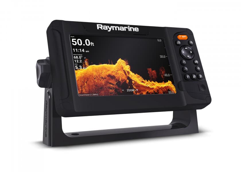
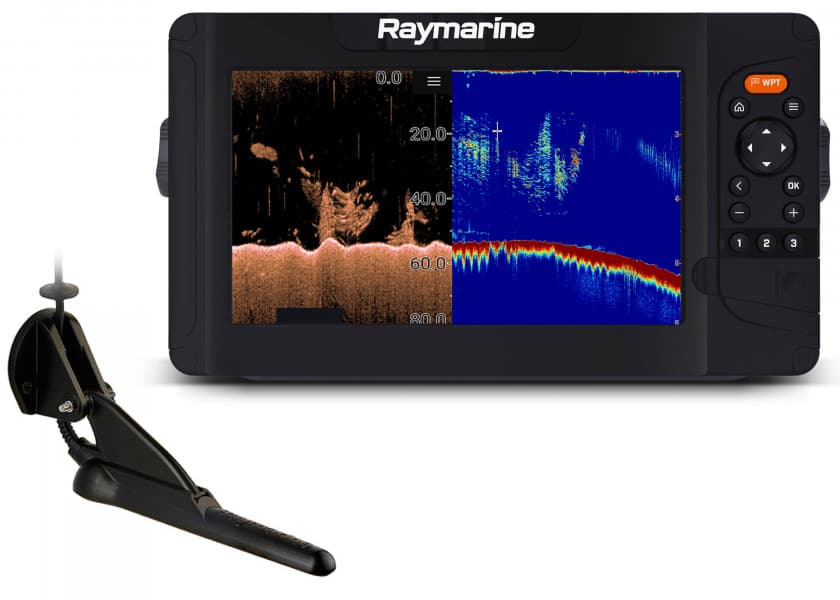
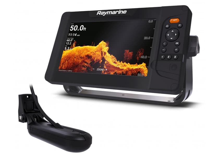
Experience the Clarity of CHIRP STRIKER 4 fishfinder includes a Garmin CHIRP (77/200 kHz) transducer, which provides a visibly higher level of clarity and detail for fish and structure than traditional 77/200 kHz transducers. Instead of sending just 1 single frequency, CHIRP sends a continuous sweep of frequencies, ranging from low to high, then interprets them individually upon their return. Since the frequencies provide a wider range of information, CHIRP sonar technology can create crisper fish arches with greater target separation. You also can upgrade to high-performance Garmin CHIRP technology, which provides crystal-clear sonar images with even more remarkable target separation and resolution from shallow to deeper depths. For better fishing, bottom contours are more visible, even at higher speeds, and signal noise can be suppressed at greater depths to provide a more timely interpretation of what’s below. Mark Spots with High-sensitivity GPS Unlike regular fishfinders, STRIKER fishfinders have built-in, high-sensitivity GPS to locate your current position quickly and precisely, then maintain your GPS location anywhere you go on the lake. More importantly, they allow you to mark spots where the fish are biting so you can return to them again in the future. You also can mark docks, boat ramps and other locations on the lake. Just follow the path created on your screen to return to them whenever you wish. 
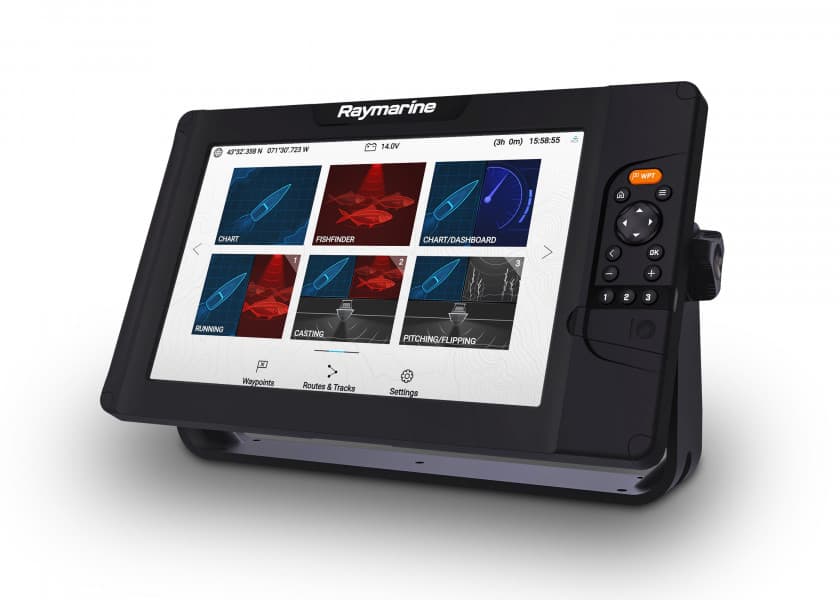
Navigate Easily with Waypoint Map Since the STRIKER fishfinder series includes high-sensitivity GPS, you can see your position in relation to waypoints you have marked. Use the waypoint map to easily view, mark and navigate to locations such as brush piles, stumps and docks. It’s also a great tool for finding your way back to the boat ramp. Check Your Speed on Screen You can quickly and easily see your boat’s speed on the screen of your STRIKER fishfinder. It’s a great tool to make sure you are trolling at the right speed for the lure you’re using and for a particular fish species. It’s also a good way to tell if you are going the right speed in wake-controlled areas. Fish Vertically with Built-in Flasher STRIKER provides you with both a fishfinder and flasher all in 1 unit. Anytime you are stationary fishing, such as ice fishing or jigging for crappie, the built-in flasher will show you the bottom, whether it is solid or muddy, your jig or weighted bait, and the depth of fish as they swim into the sonar beam. You can even watch how high your jig is being lifted and dropped and whether fish move toward or away from it. Take Your Fishfinder Anywhere A portable kit is available to protect and carry your STRIKER fishfinder with GPS, so it’s perfect for kayak, canoe or ice fishing. It includes a sealed, rechargeable battery with charger, built-in transducer cable management and storage and suction cup transducer mount and float. Technical Data: Dimensions 9.1 x 15.0 x 4.1 cm Display size, W x H 4.9 x 7.3 cm; diag.: 8.7 cm (3.5 Zoll) Display resolution, W x H 480 x 320 pixels Display type HVGA colour Weight 230 g Water rating IPX7 Audible alarms Yes Dual-frequency compatible Yes Dual-beam compatible Yes Frequencies supported Traditional: 50/77/200 kHz CHIRP (mid and high) Transmit power 200 W (RMS) Maximum depth 488 m (1,600 ft) in freshwater*, 229 m (750 ft) in saltwater* Bottom-Lock (shows return from the bottom up) Yes Water temperature log and graph Yes Split-screen zoom Yes Ultrascroll™ (displays fish targets at higher boat speeds) Yes Fish Symbol ID (helps identify fish targets) Yes AutoGain Technology (minimizes clutter, maximizes targets) Yes Adjustable depth line (measures depth of underwater objects) Yes A-Scope (real time display of fish passing through transducer beam) Yes Water temperature sensor included Yes Additional features Tilt/swivel mount, Integrated GPS, Mark waypoints, Course over ground (COG) Delivery contents STRIKER 4, Dual-Beam transducer with 6,1 m connecting cable, Transom and trolling motor mounts, Tilt/swivel mount, Power cable, Documentation Features Discover the features that make this product stand out. From technical details to special functions – we’ve summarized all the key information for you. Display size 4 Inch Operating mode Keys With transducer NMEA0183 No Radar capable No Sonar module Yes Viewing angle Downwards Sonar view Fish Bottom structure
STRIKER CAST Castable Sonar Device / with GPS
100%

STRIKER CAST Castable Sonar Device/ with GPS

GARMIN
Easily find and catch more fish with the STRIKER Cast sonar device. Just cast it out, and reel it back in to display the sonar images in an app on your smartphone or tablet. Suitable for fresh and salt water. Scans of fish and structure are easy to interpret. Choose between a conventional 2D sonar and ice fishing flasher modes. Turn on fish icons to know exactly where to drop your line. Power savvy with extended battery life STRIKER Cast automatically powers on when it’s floating in water — and turns off when it’s not. The rechargeable battery lets you go for more than 10 hours between charges. The battery can be charged via USB. GPS for user created maps Built-in GPS lets you create your own Quickdraw maps with 0.4 m contours. So the best fishing spots will be remembered forever. Further features at a glance Light, rugged and durable Waterproof to IPX6 and IPX7 Suitable for freshwater and saltwater Integrated sensor for water temperature NOTE! For casting, a fishing line with a payload of at least 9 kg is recommended. Technical specifications Sonar frequency 260/455 kHz Max. depth 0.6 to 45 m Streaming range 60 m Battery life > 10 hours Operating temperature -20 to +60 °C Water rating IPX7 GPS Yes Dimensions 76 x 76 x 58 mm Weight: 75 g
STRIKER CAST Castable Sonar Device / without GPS
100%

STRIKER CAST Castable Sonar Device/ without GPS

GARMIN
Easily find and catch more fish with the STRIKER Cast sonar device. Just cast it out, and reel it back in to display the sonar images in an app on your smartphone or tablet. Suitable for freshwater and saltwater. Multi-faceted and user-friendly sonar device Scans of fish and structure are easy to interpret. Choose between a conventional 2D sonar and ice fishing flasher modes. Turn on fish icons to know exactly where to drop your line. Power savvy with extended battery life STRIKER Cast automatically powers on when it’s floating in water — and turns off when it’s not. The rechargeable battery lets you go for more than 10 hours between charges. The battery can be charged via USB. Further features at a glance Light, rugged and durable Waterproof to IPX6 and IPX7 Suitable for freshwater and saltwater Integrated sensor for water temperature NOTE! For casting, a fishing line with a payload of at least 9 kg is recommended. Technical specifications Sonar frequency 260/455 kHz Max. depth 0.6 to 45 m Streaming range 60 m Battery life > 10 hours Operating temperature -20 to +60 °C Water rating IPX7 GPS No Dimensions 76 x 76 x 58 mm Weight: 75 g Included STRIKER Cast, bag, tether (6 m) and USB cable
STRIKER VIVID 4cv Fishfinder with GT20-TM Transom Transducer
100%

STRIKER VIVID 4cv Fishfinder with GT20-TM Transom Transducer

GARMIN
Thanks to innovative colour options you can see fish and structures like never before! The Fishfinder STRIKER Cast from Garmin features high-resolution sonar images, excellent contrast and integrated GPS. This means that your favourite fishing spots can be easily marked so that you can find your way back there at any time. Crystal clear, colourful sonar images Choose from seven new and vibrant colour options to see fish and structures in maximum clarity and contrast on your 4" fishfinder. The GT20 transom transducer included reliably delivers traditional CHIRP and ClearVü sonar images. High sensitivity GPS Plan and create routes and view your boat’s speed on your fishfinder using high-sensitivity GPS. Use waypoint marking for hot spots. Easily mark the positions of good fishing spots, docks or slipways to find them again later. All you have to do is follow the route shown on your display. The GPS can display your speed so that you are always on the right track for your lure or speed limits. Quickdraw contours With the innovative Quickdraw function you can create your own HD fishing charts. Technical data Display size 4" Display resolution 272 x 480 px Display type QSVGA Supported frequencies CHIRP classic: 50/77/200 kHz CHIRP: mid and high ClearVü: 260/455/800 kHz Transmission power 300 W Max. depth CHIRP: 244 m (800 ft) ClearVü: 153 m (500 ft) Dual frequency sonar Yes Dual beam Yes Bottom-Lock (shows return from the bottom up) Yes Water temperature log and graph Yes Split-screen zoom Yes Ultrascroll™ (displays fish targets at higher boat speeds) Yes Fish symbol id (helps identify fish targets) Yes Autogain technology (minimizes clutter, maximizes targets) Yes Adjustable depth line (measures depth of underwater objects) Yes A-scope (real time display of fish passing through transducer beam) Yes Water temperature sensor included Yes Integrated GPS Yes Water rating IPX7 Dimensions 98 x 174 x 45 mm Weight: 0.3 kg Included STRIKER VIVID 4cv, GT20-TM transom transducer, Power and data cable, mount, hardware and documentation Features Discover the features that make this product stand out. From technical details to special functions – we’ve summarized all the key information for you. Display size 4 Inch Operating mode Keys With transducer NMEA0183 No Radar capable No Sonar module Yes Viewing angle Downwards Sonar view Fish Bottom structure
STRIKER VIVID 5cv Fishfinder with GT20-TM Transom Transducer
100%

STRIKER VIVID 5cv Fishfinder with GT20-TM Transom Transducer

GARMIN
Thanks to innovative colour options you can see fish and structures like never before! The Fishfinder STRIKER Cast from Garmin features high-resolution sonar images, excellent contrast and integrated GPS. This means that your favourite fishing spots can be easily marked so that you can find your way back there at any time. Crystal clear, colourful sonar images Choose from seven new and vibrant colour options to see fish and structures in maximum clarity and contrast on your 5" fishfinder. The GT20 transom transducer included reliably delivers traditional CHIRP and ClearVü sonar images. High sensitivity GPS Plan and create routes and view your boat’s speed on your fishfinder using high-sensitivity GPS. Use waypoint marking for hot spots. Easily mark the positions of good fishing spots, docks or slipways to find them again later. All you have to do is follow the route shown on your display. The GPS can display your speed so that you are always on the right track for your lure or speed limits. Quickdraw contours With the innovative Quickdraw function you can create your own HD fishing charts. Technical data Display size 5" Display resolution 800 x 480 px Display type WVGA Color Supported frequencies CHIRP classic: 50/77/200 kHz CHIRP: mid and high ClearVü: 260/455/800 kHz Transmission power 500 W Max. depth CHIRP: 244 m (800 ft) ClearVü: 153 m (500 ft) Dual frequency sonar Yes Dual beam Yes Bottom-Lock (shows return from the bottom up) Yes Water temperature log and graph Yes Split-screen zoom Yes Ultrascroll™ (displays fish targets at higher boat speeds) Yes Fish symbol id (helps identify fish targets) Yes Autogain technology (minimizes clutter, maximizes targets) Yes Adjustable depth line (measures depth of underwater objects) Yes A-scope (real time display of fish passing through transducer beam) Yes Water temperature sensor included Yes Integrated GPS Yes Water rating IPX7 Dimensions 118 x 116 x 54 mm Weight: 0.5 kg Included STRIKER VIVID 5cv, GT20-TM transom transducer, Power and data cable, Mounting bracket hardware and documentation Features Discover the features that make this product stand out. From technical details to special functions – we’ve summarized all the key information for you. Display size 5 Inch Operating mode Keys With transducer NMEA0183 No Radar capable No Sonar module Yes Viewing angle Downwards Sonar view Fish Bottom structure
STRIKER VIVID 7cv Fishfinder with GT20-TM Transom Transducer
100%

STRIKER VIVID 7cv Fishfinder with GT20-TM Transom Transducer

GARMIN
Thanks to innovative colour options you can see fish and structures like never before! The Fishfinder STRIKER Cast from Garmin features high-resolution sonar images, excellent contrast and integrated GPS. This means that your favourite fishing spots can be easily marked so that you can find your way back there at any time. Crystal clear, colourful sonar images Choose from seven new and vibrant colour options to see fish and structures in maximum clarity and contrast on your 7" fishfinder. The GT20 transom transducer included reliably delivers traditional CHIRP and ClearVü sonar images. High sensitivity GPS Plan and create routes and view your boat’s speed on your fishfinder using high-sensitivity GPS. Use waypoint marking for hot spots. Easily mark the positions of good fishing spots, docks or slipways to find them again later. All you have to do is follow the route shown on your display. The GPS can display your speed so that you are always on the right track for your lure or speed limits. WiFi connectivity and Quickdraw contours Connect to the ActiveCaptain app using WiFi to transfer waypoints, get smart notifications and access the Garmin Quickdraw community. You can also create your own HD fishing charts. Technical data Display size 7" Display resolution 800 x 480 px Display type WVGA Color Supported frequencies CHIRP classic: 50/77/200 kHz CHIRP: mid and high ClearVü: 260/455/800 kHz Transmission power 500 W Max. depth CHIRP: 244 m (800 ft) ClearVü: 153 m (500 ft) Dual frequency sonar Yes Dual beam Yes Bottom-Lock (shows return from the bottom up) Yes Water temperature log and graph Yes Split-screen zoom Yes Ultrascroll™ (displays fish targets at higher boat speeds) Yes Fish symbol id (helps identify fish targets) Yes Autogain technology (minimizes clutter, maximizes targets) Yes Adjustable depth line (measures depth of underwater objects) Yes A-scope (real time display of fish passing through transducer beam) Yes Water temperature sensor included Yes Integrated GPS Yes Water rating IPX7 Dimensions 235 x 140 x 58 mm Weight: 0.8 kg Included STRIKER VIVID 7cv, GT20-TM transom transducer, Power and data cable, Mounting bracket hardware and documentation Features Discover the features that make this product stand out. From technical details to special functions – we’ve summarized all the key information for you. Display size 7 Inch Operating mode Keys With transducer NMEA0183 No WiFi Radar capable No Sonar module Yes Viewing angle Downwards Sonar view Fish Bottom structure
STRIKER VIVID 7sv Fishfinder with GT52HW-TM Transom Transducer
100%

STRIKER VIVID 7sv Fishfinder with GT52HW-TM Transom Transducer

GARMIN
Thanks to innovative colour options you can see fish and structures like never before! The Fishfinder STRIKER Cast from Garmin features high-resolution sonar images, excellent contrast and integrated GPS. This means that your favourite fishing spots can be easily marked so that you can find your way back there at any time. Crystal clear, colourful sonar images Choose from seven new and vibrant colour options to see fish and structures in maximum clarity and contrast on your 7" fishfinder. The GT52 transom transducer included reliably delivers traditional CHIRP, ClearVü and SideVü sonar images. High sensitivity GPS Plan and create routes and view your boat’s speed on your fishfinder using high-sensitivity GPS. Use waypoint marking for hot spots. Easily mark the positions of good fishing spots, docks or slipways to find them again later. All you have to do is follow the route shown on your display. The GPS can display your speed so that you are always on the right track for your lure or speed limits. WiFi connectivity and Quickdraw contours Connect to the ActiveCaptain app using WiFi to transfer waypoints, get smart notifications and access the Garmin Quickdraw community. You can also create your own HD fishing charts. Technical data Display size 7" Display resolution 800 x 480 px Display type WVGA Color Supported frequencies CHIRP classic: 50/77/200 kHz CHIRP: mid and high ClearVü and SideVü: 260/455/800 kHz Transmission power 500 W Max. depth CHIRP: 244 m (800 ft) ClearVü: 153 m (500 ft) SideVü: 153 m (500 ft) Dual frequency sonar Yes Dual beam Yes Bottom-Lock (shows return from the bottom up) Yes Water temperature log and graph Yes Split-screen zoom Yes Ultrascroll™ (displays fish targets at higher boat speeds) Yes Fish symbol id (helps identify fish targets) Yes Autogain technology (minimizes clutter, maximizes targets) Yes Adjustable depth line (measures depth of underwater objects) Yes A-scope (real time display of fish passing through transducer beam) Yes Water temperature sensor included Yes Integrated GPS Yes Water rating IPX7 Dimensions 235 x 140 x 58 mm Weight: 0.8 kg Included STRIKER VIVID 7sv, GT52 HW-TM transom transducer, Power and data cable, 12-pin to 4-pin adapter cable, Mounting bracket, hardware and documentation Features Discover the features that make this product stand out. From technical details to special functions – we’ve summarized all the key information for you. Display size 7 Inch Operating mode Keys With transducer NMEA0183 No WiFi Radar capable No Sonar module Yes Viewing angle Downwards Sidewards Sonar view Fish Bottom structure
STRIKER VIVID 9sv Fishfinder with GT52HW-TM Transom Transducer
100%

STRIKER VIVID 9sv Fishfinder with GT52HW-TM Transom Transducer

GARMIN
Thanks to innovative colour options you can see fish and structures like never before! The Fishfinder STRIKER Cast from Garmin features high-resolution sonar images, excellent contrast and integrated GPS. This means that your favourite fishing spots can be easily marked so that you can find your way back there at any time. Crystal clear, colourful sonar images Choose from seven new and vibrant colour options to see fish and structures in maximum clarity and contrast on your 9" fishfinder. The GT52 transom transducer included reliably delivers traditional CHIRP, ClearVü and SideVü sonar images. High sensitivity GPS Plan and create routes and view your boat’s speed on your fishfinder using high-sensitivity GPS. Use waypoint marking for hot spots. Easily mark the positions of good fishing spots, docks or slipways to find them again later. All you have to do is follow the route shown on your display. The GPS can display your speed so that you are always on the right track for your lure or speed limits. WiFi connectivity and Quickdraw contours Connect to the ActiveCaptain app using WiFi to transfer waypoints, get smart notifications and access the Garmin Quickdraw community. You can also create your own HD fishing charts. Technical data Display size 9" Display resolution 800 x 480 px Display type WVGA Color Supported frequencies CHIRP classic: 50/77/200 kHz CHIRP: mid and high ClearVü and SideVü: 260/455/800 kHz Transmission power 500 W Max. depth CHIRP: 244 m (800 ft) ClearVü: 153 m (500 ft) SideVü: 153 m (500 ft) Dual frequency sonar Yes Dual beam Yes Bottom-Lock (shows return from the bottom up) Yes Water temperature log and graph Yes Split-screen zoom Yes Ultrascroll™ (displays fish targets at higher boat speeds) Yes Fish symbol id (helps identify fish targets) Yes Autogain technology (minimizes clutter, maximizes targets) Yes Adjustable depth line (measures depth of underwater objects) Yes A-scope (real time display of fish passing through transducer beam) Yes Water temperature sensor included Yes Water rating IPX7 Dimensions 282 x 165 x 60 mm Weight: 1.1 kg Included STRIKER VIVID 9sv, GT52 HW-TM transom transducer, Power and data cable, 12-pin to 4-pin adapter cable, Mounting bracket, hardware and documentation Features Discover the features that make this product stand out. From technical details to special functions – we’ve summarized all the key information for you. Display size 9 Inch Operating mode Keys With transducer NMEA0183 No WiFi Radar capable No Sonar module Yes Viewing angle Downwards Sidewards Sonar view Fish Bottom structure