BoatPartsManual.com Logo
BoatPartsManual.comFind exact matching boat parts at once!
FeedbackLoginSign UpProfileWishlistChatAdd ProductLog Out

Menu

FeedbackLoginSign Up

© 2025 BoatPartsManual.com. All Rights Reserved.

Select your boat's brand and model to find compatible parts.

Product Categories

All Categories
Anchoring & Docking
Boats, Tenders & Watersports
Cabin, Galley & Comfort
Clothing & Apparel
Deck & Sailing Hardware
Electrical & Power
Electronics & Navigation
Engine, Propulsion & Trailering
Fishing
Maintenance & Care
Navigation, Charts & Books
Plumbing & Sanitation
Safety
  1. Home
  2. Categories
  3. Electronics & Navigation
  4. Navigation Displays & Systems
  5. Handheld GPS
  6. (10)
Sort by:
Back to Navigation Displays & Systems
Sort by:

Handheld GPS

(10)

Filters

Bag for Handheld GPS
100%

Bag for Handheld GPS

GARMIN
Protect your handheld GPS with this durable bag. Colour: Black.
Bivy Stick Satellite Communicator
100%

Bivy Stick Satellite Communicator

ACR
Turn your phone into a satellite communicator with the Bivy Stick. Use the Bivy Stick to communicate from anywhere you have a view of the sky thanks to global satellite coverage provided by the Iridium satellite network. With the ACR Bivy Stick you can communicate with emergency services and get rescued anywhere in the world through SOS monitoring provided by the Global Rescue Organisation. Note As is customary for satellite communication devices, a subscription is required to use the ACR Bivy Stick. For more information on the various subscription plans, visit the ACR Bivy website. Practical and compact, the Bivy Stick offers a comprehensive feature set including two-way text messaging, SOS, location sharing, one-touch check-in and detailed weather forecasts sent directly to your phone via satellite. Furthermore, the Bivy Stick provides users with a dedicated phone number and email, a feature not provided with many other satellite communicators. This important feature allows unsolicited incoming messages, which means that those who are most important to you can contact you at any time, without you having to initiate contact. 
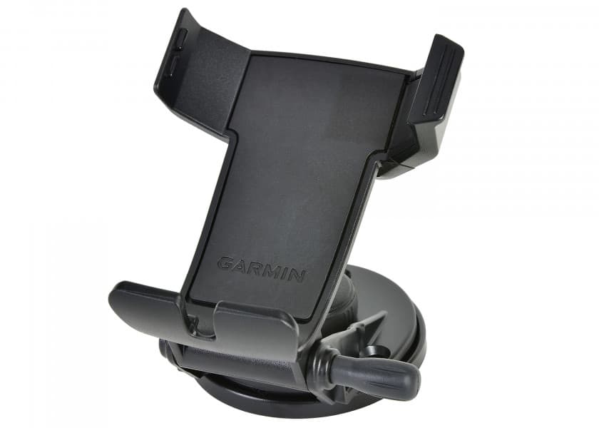
Hundreds of mounting options are available, allowing you to attach the Bivy Stick to any vehicle or backpack, making it the ideal device for adventurers going from one activity to another. . Features No activation fees, 4 different subscription plans to choose from. Further information can be found on ACR Bivy website. Global satellite coverage (Iridium network) Send and receive messages via satellite Latest weather forecasts SOS monitoring via Global Rescue Organisation Track your journey and share with friends via the Bivy website Use the Bivy offline topo maps on your smartphone and access thousands of mapped climbing, hiking, biking, paddling, skiing routes Dedicated phone number and email Small and light design Technical data Dimensions: 11.35 cm (L) x 4.7 cm (wide) x 2.11 cm (thick) Weight: 100 g Waterproof according to: IPX7 Battery type: Lithium Ion Polymer (1400 mAh) Battery life: Up to 120 hours (standard operation at default setting) Interface: USB-C & Bluetooth 4 SOS emergency call activation: Manually via the Bivy Stick or the Bivy App Bivy App available to download: Via the App Store (Apple) or Google Play Store (Android) Delivery contents: 
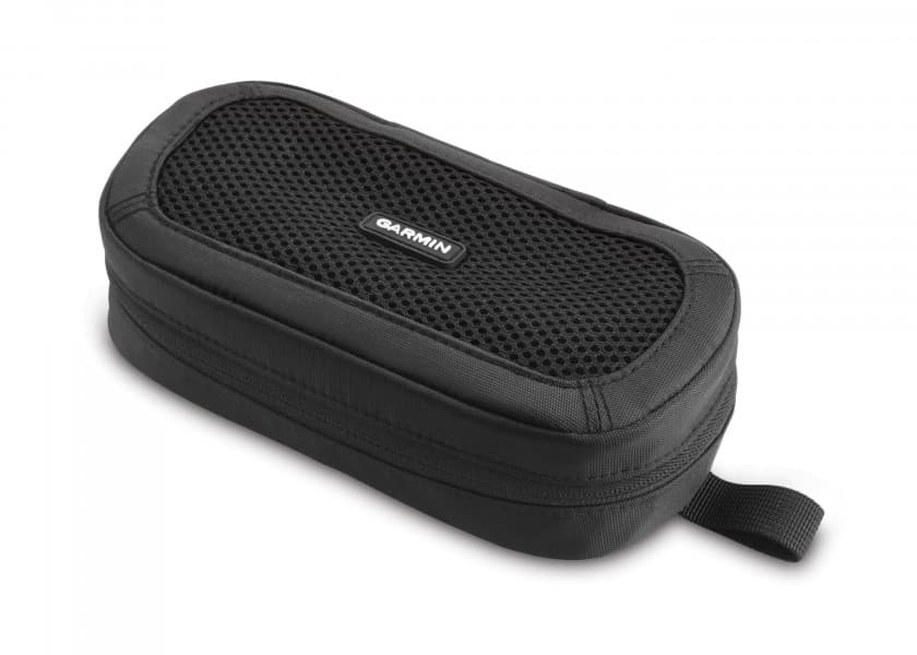
Bivy stick, USB-C charging cable, carabiner, strap
GPS 73
100%

GPS 73

GARMIN
The GPS 73 is an easy-to-use handheld device, which is the perfect navigational solution for boats, sailboats or small watercraft that do not have a chartplotter.
GPSMAP 79s
100%

GPSMAP 79s

GARMIN
Note: The matching Garmin blueChart g3 sea charts can only be purchased from the Garmin online shop or via the Garmin Express PC software. Pre-programmed maps sold through retail outlets are not compatible with the device. The tough, floating GPSMAP 79s handheld was designed specifically for use on boats. It has a high-resolution colour display that is easy to read even in bright sunlight. The integrated GPS receiver allows the exact position to be displayed at all times and a compass shows you the way. BlueChart g3 marine charts are also supported. Great Battery Life Two user replaceable AA batteries (not included) provide up to 19 hours life. Accurate Tracking The device supports multiple satellite constellations and guarantees reliable, accurate tracking and positioning worldwide. Support includes GPS, GLONASS, Galileo, QZSS and SBAS constellations. Increased Memory With more memory than previous models, up to 10,000 waypoints, 250 routes and 300 fitness activity files can be saved and tracked. Built-in Compass The electronic 3-axis compass with tilt compensation shows your heading, even when the boat is not moving. Further features at a glance Point-to-Point Navigation Area Calculation Hunt/Fish Calendar Geocaching Mode Custom Maps Compatible Picture Viewer Rinex Logging Technical Data Display size 38 x 63 mm (3") Resolution 240 x 400 px Display type TFT display with 65,000 colours Battery 2 AA batteries (sold separately) Battery life <19 h GPS receiver Yes Compass Yes NMEA2000 compatible Yes USB Yes Built-in memory 8GB External memory storage Yes (max 32 GB) waypoints 10,000 Tracks 250 Buoyant Yes Waterproof rating IPX7 Dimensions (WxHxD) 68 x 174 x 42 mm Weight: 282 g Delivery contents: GPSMAP 79s Carrying lanyard USB cable Documentation
GPSMAP 86i / inReach
100%

GPSMAP 86i / inReach

GARMIN
The GPSMAP 86i is a stand-alone backup navigation device that also serves as an extension to the marine system with wireless connectivity. The 3" display is easy to read even in sunlight and provides a better overview and additional practical functions, such as satellite communication for interactive SOS emergency calls. Connecting to the boat Wireless connectivity allows you to connect the GPSMAP 86i to compatible Garmin multifunction displays. You can receive real-time ship data directly to your handset or conveniently operate autopilots or FUSION marine products. When you're on the move, the customisable GPS filter adjusts the speed and heading readings in swell to improve tracking accuracy. Satellite communication Stay connected globally with GPSMAP 86i thanks to integrated inReach satellite technology and additional service options. You can send and receive two-way SMS messages, track and share your route, and make an interactive SOS emergency call when needed to get help from a 24x7 global monitoring centre via the Iridium satellite network with 100% global coverage. Receive weather forecasts directly on the device and make informed decisions based on field or destination conditions. Optional BlueChart g3 charts You can add a BlueChart g3 coastal chart using the microSD card slot, providing industry-leading coverage, clarity and detail with integrated data from Garmin and Navionics®. A global base chart is pre-installed. Detailed depth contours allow you to see up to 0.3 meters of contours, making it easier to visualise bottom structures. The result is optimised fishing charts and additional details for marshes, channels and harbour maps. Always connected Get Smart Notifications directly on your GPSMAP 86i handset when paired with your compatible smartphone. You can also sync your GPSMAP 86i device with the Garmin Explore-Portal to manage your favourite waypoints, tracks, and routes in the cloud. The GPSMAP 86i device supports WLAN, ANT+ technology, and Bluetooth wireless technology so you can easily update and connect wirelessly. For long journeys, a built-in lithium battery provides up to 35 hours of battery life in 10-minute tracking mode. Features at a glance Water-resistant, floatable, easy to read even in sunlight, 3 inch display, button operation for easy use on the water Stream ship data from compatible chartplotters and instruments to consolidate information from your marine system Always connected with inReach satellite communications and two-way SMS via Iridium satellite network with 100% global coverage (satellite subscription required) Serves as remote control for convenient operation of your Garmin autopilot and selected FUSION marine products Supports optional BlueChart g3 charts Adjustable GPS filter for smoothing speed and heading displays in rough seas Pair with your compatible smartphone to receive smart notifications Sun and moon calendars Hunting and fishing calendar Area calculation Technical specifications Dimensions (WxHxD) 70 x 178 x 44 mm Display size 3" Display resolution 240 x 400 px Weight 272 g Battery Lithium-ion battery Battery Life Up to 35 hours in 10-minute tracking mode; up to 200 hours in expedition mode Waterproof IPX7 Memory 16 GB GPS receiver Yes Barometric altimeter Yes Compass Yes Bluetooth Yes WiFi Yes USB Yes NMEA0183 compatible Yes Charts BlueChart G3 Card slot microSD Satellite communications Yes Garmin Connect compatible Yes Included GPSMAP 86i handset with worldwide base chart Mount with power supply Wrist strap USB to micro USB cable USB to 2-pin cable Mounting kit Documentation 70 x 178 x 44 mm
inReach Mini 2 Satellite Communicator / black
100%

inReach Mini 2 Satellite Communicator/ black

GARMIN
With the compact inReach Mini 2 GPS satellite communicator you can send and receive messages worldwide. Instead of a mobile phone network, the device transfers messages via the Iridium satellite network and, in case of an emergency, triggers an interactive SOS message to the IERCC international rescue centre, which is manned 24/7. The communication device also has a digital compass and TrackBack routing for accurate heading information so that you don't lose track of where you are. With a battery life of 14 days and a weight of just 100 g, the inReach Mini 2 is perfect for longer trips or cruises. It can also be connected to the Garmin Explore app. Overview of features: Compact GPS satellite communication device Emergency call at the touch of a button using worldwide Iridium satellite coverage Global two-way communication - even without a mobile network Long battery life of up to 14 days in 10-minute tracking mode TrackBack routing for better orientation Digital compass Compatible with Garmin Explore app Technical data Display size 23 x 23 mm Resolution 176 x 176 px Display type Transflective MIP display Battery Lithium-ion battery Battery life Up to 14 days (in 10-minute tracking mode) Up to 30 days (in 30-minute standard tracking mode) Connectivity Bluetooth, ANT+ Interface USB-C Digital compass Yes GPS receiver Yes Satellite network GPS, GALILEO, QZSS, Beidou Waterproof IPX7 Dimensions 51.7 x 99 x 26.1 mm Weight: 100 g Colour Black Included in delivery inReach Mini 2, USB cable, carabiner, documentation
inReach Mini 2 Satellite Communicator / orange
100%

inReach Mini 2 Satellite Communicator/ orange

GARMIN
With the compact inReach Mini 2 GPS satellite communicator you can send and receive messages worldwide. Instead of a mobile phone network, the device transfers messages via the Iridium satellite network and, in case of an emergency, triggers an interactive SOS message to the IERCC international rescue centre, which is manned 24/7. The communication device also has a digital compass and TrackBack routing for accurate heading information so that you don't lose track of where you are. With a battery life of 14 days and a weight of just 100 g, the inReach Mini 2 is perfect for longer trips or cruises. It can also be connected to the Garmin Explore app. Overview of features: Compact GPS satellite communication device Emergency call at the touch of a button using worldwide Iridium satellite coverage Global two-way communication - even without a mobile network Long battery life of up to 14 days in 10-minute tracking mode. TracBack routing for better orientation Digital compass Compatible with Garmin Explore app Technical data Display size 23 x 23 mm Resolution 176 x 176 px Display type Transflective MIP display Battery Lithium-ion battery Battery life Up to 14 days (in 10-minute tracking mode) Up to 30 days (in 30-minute standard tracking mode) Connectivity Bluetooth, ANT+ Interface USB-C Digital compass Yes GPS receiver Yes Satellite network GPS, GALILEO, QZSS, Beidou Waterproof IPX7 Dimensions 51.7 x 99 x 26.1 mm Weight: 100 g Colour Black Included in delivery inReach Mini 2, USB cable, carabiner, documentation
Mounting Bracket for GPSmap 78/78s and GPS 73
100%

Mounting Bracket for GPSmap 78/ 78s and GPS 73

GARMIN
Mounting bracket for the handheld GPSmap 78 / 78s and the handheld GPS 73 from GARMIN.
Power Cable for the GPS 72 / 72H / 73 / 78 / 78s with lighter plug
100%

Power Cable for the GPS 72/ 72H/ 73/ 78/ 78s with lighter plug

GARMIN
Power cord with lighter plug. Compatible with the following GARMIN GPS models: GPS 72 / GPS 72 H GPSMap 78 / GPSMap 78s
Travel Charger for Handheld GPSMAP
100%

Travel Charger for Handheld GPSMAP

GARMIN
Get the most out of your trip with the right charging cable for selected GARMIN devices. The adapter plugs can be used to connect to the European, British and Northern Irish power networks. Compatible devices: GPS 73 GPSMAP 62s GPSMAP 64 GPSMAP 64s GPSMAP 78 GPSMAP 86i GPSMAP 86s inReach Explorer + inReach SE +